Wednesday, December 19, 2012

Day 5: Syracuse to Failure.


My hosts Casey and Rei in Syracuse, were incredibly gracious. I've yet to have a bad experience through Warm Showers (and this is stay number 4). In the morning they made me some oatmeal and some delicious coffee, which really hit the spot. When I stepped out the front door, rain started coming down, my biggest fear of tour. It was a light drizzle and seemed to be slowing down. As I left, the flags were pointing straight to the Pacific Coast as I headed towards the Atlantic, right there I knew it was going to be tough.

Morning, canal.
Goose!

The morning wasn't terrible, but it wasn't great. The air temperature had risen at first and as I had expected the rain eventually disappeared, but the head wind did not. I pushed forward through more desolate farmland of Central NY. It's surprising how the further east I go, getting closer to the crowded Hudson and the endless endless sprawl of NYC, things actually ended up seeming less built up. I passed through the tiny canal town of Canastota where I called my host for that night and tried out some handwarmers that Casey and Rei had donated to my trip, I tried to get them on before my toes and fingers got too cold.

A fort in Rome, NY.
The garrison.

That was the last good memory of this tour. The beautiful isolation from townships and cars continued, but the wind was defeating my spirit and the rain absolutely killed it. About 20 miles outside of Rome, my legs were feeling the 90 miles the day before and the force to keep around 12 MPH in the wind was wearing them thin. I avoided the path from there on out, hoping the pavement would help me keep up my speed, but once it started pouring on me, I knew this was it. I didn't want to call it quits, but at this point I was soaked and the wind was ripping through my leg warmers and the hand warmers were not doing what they were supposed to. I hated calling it quits, but it was 60 miles to my hosts' house that night. I considered the possibility of adding another day, but that would have added several hotel stays, which rapidly increases the cost of the trip, plus the rain was now dipping the temperature in that danger zone of 35 degree rain, frigidly cold and dangerously wet. I just knew I had to quit. I pulled into a Subway, the first vegan friendly spot I saw, and called it in to my host and my mom. I'd hope to catch a train in Rome. Due to some struggles with getting my bike on the train, I ended up having to take a Greyhound from Utica, but I finished the night at 3 AM in my childhood bedroom on Long Island. Erie Canal Tour over.

Last view of the canal.
Last bridge over the canal.

Quitting felt weak, but honestly, sometimes you have to know when to end it and it was obvious at that point. I arrived at Utica at 4 PM, with the sun almost down and another 40 miles to go to my hosts that night, which meant I would  be in the dark for at least 3 hours, which sounded scary and unfun. It's easy for me to say that it was the weather that made me quit, but that's not true, I was actually hoping for worse weather and snow, the problem was planning 90 mile days in 8 hours of daylight. During my summer tour, doing 90 mile days was not that hard, but I was also taking long breaks midday, which I could not afford to do now with significantly shorter days. Plus, avoiding those long breaks meant I wasn't seeing much, was it really worth it to ride 90 miles a day and then pass out exhausted and cold? I really didn't think so. Being defeated has me only antsy for what tour I should do next. I'm looking forward to going back to the Bay Area and hopefully bike camping sometime soon.


Tuesday, December 18, 2012

Day 4: Rochester to Syracuse


After a few days of R 'n R with old college friends in Rochester, it was time to hit the road again. It wasn't far from my friend's house to the path in Pittsford, once on the path it was the same as the first day, the same gravel towpath and the canal had the same width. Even though things looked the same, I was enjoying being on the path, mostly because it was so quiet, no traffic to speak of.

Pittsfield, NY. Said to walk my bike, but with no peds, why bother? I'm a rebel, I know.
The same old path.
After Palmyra, when I was figuring for a snack, I saw two ladies walking along the path, fumbling with my Cliff Bar I was able to shove it in my jacket pocket and call out my pass. I passed no problem, but then I went to continue with my Cliff Bar and this was where things got hectic. Reaching into my pocket I pulled out a glove, my MP3 player, my headphones, and my food. Grabbing too many things, I struggled to keep them in my hands. Diverting my attention from the road to the objects in my hand I began veering right. I tried to regain control, but it was too late, I was off the path and squeezing my brakes. In slow motion I watched my tire slowly roll into a log on the side of the path and I went over my handlebars.

Glad I didn't fall into any mud or water, that would have been a one way ticket to cold.
Shortly after the crash, the steed survived of course.
I was fine, but being childish I swore a bit at the bike and threw my helmet. I was okay, the only thing to get hurt was my headphones, one of them ripping off in my ear, which I suppose things could have been worse. Still, second day of riding on this tour and the second day I ended up on the ground. After this crash, I began to get down on myself a little bit. I was frustrated at falling and feeling a little worn out from spending all day in the saddle, with no time to enjoy off then bike. But as I tried to convince myself to continue the tour, the path changed from the same old to something novel. Before I reached Lyons outside of Palmyra, the leaf covered path began to bob up and down, breaking the monotony of the flat path. This gentle change in riding  began me thinking of the possibly cross racing next season and I embraced the small rolls on the path and pushed a hard pace forward. This was enough to keep me happy all the way to Lyons.

Rolling foliage.

Swamps along the canal.
Locks outside of Lyons.
Then Lyons improved my demeanor even more. Pulling into town the town center seemed small and hardly existent, but I was here and about halfway done for the day, so I decided it was lunch time. I putted around for a bit looking for someone to ask and the only person, instead someone found me. Baldy Bob was his name and he greeted boats coming along the canal in the summer time. He informed me of how the Erie Canal Bikeway is actually a fairly popular touring route in the summer, because of this Bob had met some cyclists over the years and took their pictures to post on the Lyon's community blog. He snapped my photo and gave a short history of the town, of how the canal used to run right through town, akin to how US highways run through small Midwestern towns now, the canal climbed behind the main street (now a parking lot). He also told of how Lyons gained it's notoriety, once being the world's largest peppermint exporter in the mid 19th c. People like Bob make the road worth being on. He suggested a little diner, which was very little, and due to my new vegan diet, I only had a roll and some homefries, a sad lunch indeed.

Downtown Lyons.
Baldy Bob, displaying the steed.
The bridge at Lyons.
Beyond Lyons the towpath ended. I was now traveling along Bike Route 5, a cross-state bikeway (one of three, I don't know why the numbers are so far apart, but 17 goes across the southern tier and 11 goes up into the Adirondacks). I never thought I'd say it, but bless the interstates, because NY 31 between Rochester and Syracuse seemed very untraveled, I rarely met a car on the wide shouldered road going east. I popped over a few hills and ended up marveling at the swamps surrounding the Seneca River. There was a park along the West bank of the River with a mud laden road I wish I had time to explore, but unfortunately the little amount of sunlight and an over ambitious daily mileage meant I had to keep going.

Repair boats outside Lyons, nice Empire State Blue and Gold.
There was a lot of wilderness surrounding the trail, so quiet, I love it.
An old aqueduct outside Syracuse.
After a quick stop at Port Byron, where I took some light ribbing from some comical truckers, I began the last twenty mile bit into the city center of Syracuse. I abandoned the canalway prematurely, turning off around Weedsport to get on State Highway 5 for a straight shot into the city center. This was a bad idea. Not only did 5 turn into a freeway at one point (no bikes allowed) meaning I had to reroute, but the road also had some hills I was forced to battle. I was greeted with some encouraging honks (first ones of tour), but it wasn't enough to make me forget the struggles of pressing upward. Then once I began the descents the sun started doing the same, making those rapid descents chilly. By the time I reached Camillus on the outskirts of Syracuse, I was ready to quit. The last section into Syracuse was not exactly worth seeing either. A four lane highway shouldered by large parking lotted strip malls and big box stores, basically what I now refer to, and always will refer to, as the buttholes of America (I never understood these places, but a lot of people find them very enjoyable, to each their own I suppose).

The path going towards Syracuse, it was very rural here.
Bare leaved trees and swamps, not exactly the white path I was hoping, but still the change in  seasons makes NY so different in winter.
Distant hills, being on mountain tops, these hills look pretty weak from this height, but still Central NY is rollin'.
I avoided traffic and ended up in downtown Syracuse in Clinton Square, where the canal used to cut right through the heart of downtown Syracuse (the commercial route now diverts far north of the city). Downtown Syracuse was actually pretty quaint too, with similar well lit antiquated buildings as Buffalo and Rochester with a nice downtown public skating rink (like it's fellow canal cities to the west). It wasn't much further til I reached my Warmshowers hosts' house, where we swapped stories over dinner and some beers. It was another high mileage day completed in a hearty headwind with some hills thrown in, I wasn't really sure of how many more of those days I could put in.


Friday, December 14, 2012

Day 1: Buffalo to Rochester


The drinks from the night before came back to haunt me in the morning. My alarm went off at 6 30, when I wanted to be up, I rolled over and shut it off. I woke up again somewhere around sunrise, rolled over and slept some more. Finally around 8 30, I rolled over and realized, shit I need to get going. It took me some time to pack my bags and get going (plus my host Brian woke up and so I chatted with him for a bit too), by the time I put rubber on pavement, it was near 10 AM.

The steed before setting out.
One last look at the city.
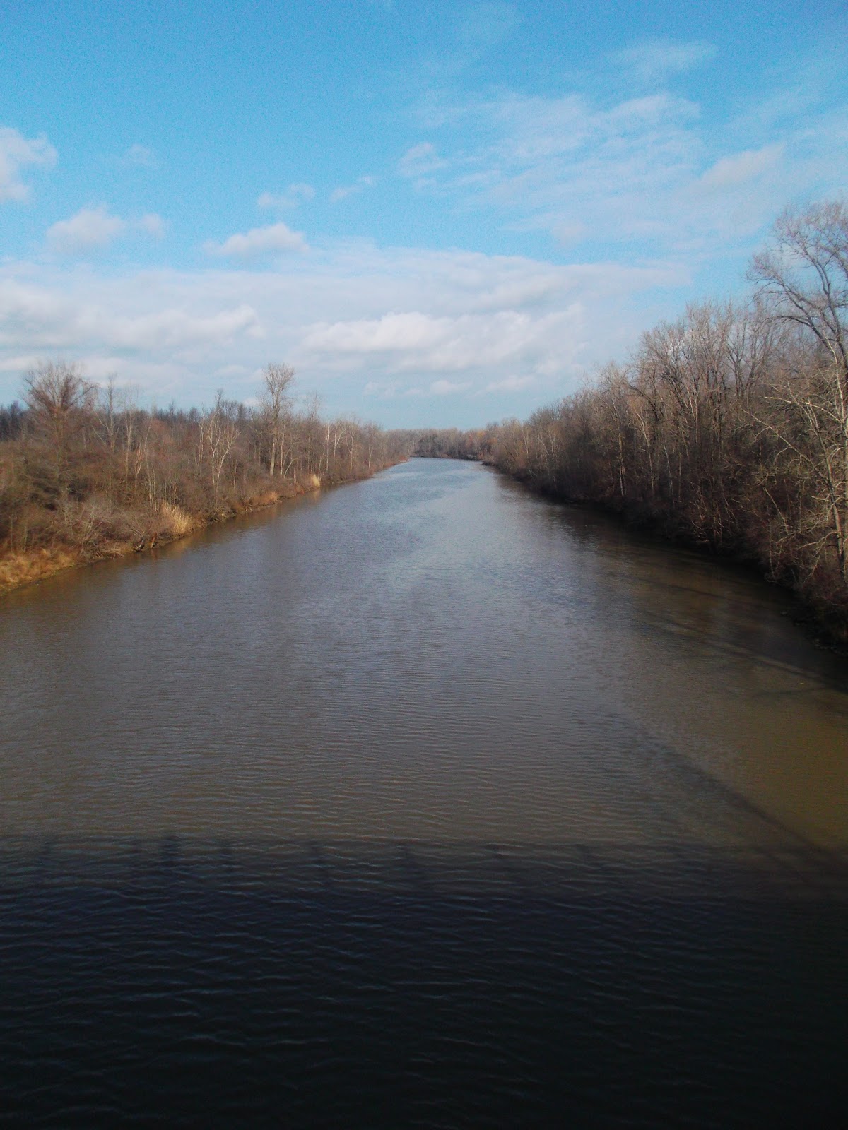
Going under the Peace Bridge
Once again I tread the familiar Riverwalk (not going through the city to Amy's Place for breakfast as I wanted, being too late), heading north towards Tonawanda Creek, the last leg of the old Erie Canal journey before Buffalo. A light snow had begun to fall, finally, I get some of the white stuff I traveled across the country to see. Luckily though it wasn't a blizzard and by the time I hit the Tonawanda Creek, the snow had dissipated.

The Tonawanda Creek path in Amherst.
Empty pathways in the cold.
My first look at the manufactured section of the canal.

After about an hour and a half on the road I was jogging along fairly nicely with a decent tailwind. The bike path was fairly clear and dry and swerved back and forth, then a wet corner struck. I leaned into the corner and my wheels slipped out from under me and I went down hard. Less than two hours in and I already found myself on the ground. My right wrist and knee took the brunt of it, but after taking a second to check myself out, I was fine. My bike on the other hand needed a little love, my brake levers were pointing inward. But I was prepared and pulled out my tools and fixed that up too. From there on out I took the corners much more timidly.

Niagara Produce in Lockport
The last lock of three in Lockport, I should have gotten a better picture of all three, oh well.

I reached Lockport around noonish and grabbed some food from a supermarket, this is my first vegan tour so it would be interesting to see how eating would be. I passed a Subway, a vegan fast food staple, but figured that to be a last ditch effort, instead I found Niagara Produce, a nice little produce market and deli. I grabbed some fruit and some trail mix, I suppose this would be my future tour compromise, living by markets instead of fast food, probably for the better anyway.

Middleport
Medina 
Waterfall behind Medina.

From Lockport the towpath began. I was now on gravel, which oddly enough made me more confident about staying upright. The canal path looked about the same all along, not changing much. Middleport was the first town I hit, I checked it out found a nice coffee shop, considered coffee, but since I had just stopped in Lockport I decided to press on, figuring the next town would most likely have coffee as well. How wrong I was. I somehow circumvented the Medina downtown and watched the Main St pass by from across the marina. The next few towns were tiny little towns that lacked any sort of business district. Albion was my only hope. I recognized the name (as I had with Medina) so I figured it would be a larger settlement. As I approached Albion I looked across the canal and realized why I recognized the name, on the south side of the canal was a large institutional brick building behind a series of chainlink fences, the last topped with razor wire. That's why I know the name, Albion State Prison. It's strange to think how this could make a town recognizable. The downtown was fairly large compared to the others passed, the largest actually I've seen on the canal (besides Lockport), but it was empty. Two blocks long and one block wide crowded with storefronts lying vacant. Albion was a bust as well.

Along the path were a lot of wide open grassy fields like this one.
I was so excited to reach Albion.
All these shops made me hopeful. False hope
By Albion I was forty miles from Lockport with no stop and my toes were starting to get icy. My feet felt like ice blocks just spinning dead weight in my toe clips. I kept spinning and passed the tiny towns of Holley and Eagle Harbor, seeing no sign of any commercial life, I just kept  going. Once I reached Brockport the sun was nearing the horizon, I decided to skip Brockport too, in hopes of reaching Rochester before nightfall.

Brockport turning on their lights before I was even finished.
I didn't. The sun was down as I crossed into the suburb of Gates, where I reentered the roadways. I stopped first at Wegman's a regional (and awesome) supermarket where I feasted on the hot bar (vegan friendly) before meeting up with my friends Mike and Sam. Even just walking off the bike for a couple minutes and getting some food in me made me feel better and riding the two miles from the supermarket to my friends' apartment I rode out of my saddle happy to put the first day behind. Day one was a series of lessons learned, leave early to get enough sunlight and stop for lunch. Two days off in Rochester before my next day of riding to Syracuse.


Thursday, December 13, 2012

Prologue: Niagara Falls


Before I came to Buffalo, I had planned a handful of rides I wanted to revisit, like ride up to Niagara Falls, or head down to the Boston Hills, or maybe even ride to South Buffalo and drink a pint in one of the Irish pubs. Then once here I became too busy to ride all over the place (I also wasted my first day in town thanks to a bone chilling rain). With only one day left in Buffalo, I forced myself to squeeze in one of these rides, so I ventured forth through the chilly weather up to Niagara Falls.

The highway and the creek.
I'm sure this matches some weird modern house somewhere.
That old industrial space was once a failed attempt at hip found space living.
The sun was way more apparent looking in this direction
I started off from the Wegman's on Amherst St. in Black Rock, to get a quick light lunch before taking off. Behind Black Rock along the Scajaquada Creek is a bike path connecting Delaware Park to the Riverwalk along the creek. Underneath the Scajaquad highway, which the city nonsensically built (I doubt it saves anyone any time really while destroying the natural streetscape and also impeding on Buffalo's treasured Delaware Park, leaving no Olmsted Park untouched by a highway now), there a bike path along the heavily polluted Scajaquada Creek (unfortunate but true) next to some old industrial brownspace, left from when the International Railroad Bridge used to bring a heavy transport industry to this part of town (now lost to the over-trafficked Peace Bridge). The path has a very unique character, that I find fits Buffalo very well. A quaint creek hidden underneath a highway surrounded by decrepit industry, any fan of urban exploring or intrigued by the oddly magnificent views of urban decay should not pass up this little path.

Riverwalk bridges.
Grand Island bridges.
The view from the bridge.
After the Scaj Path, I returned to the Riverwalk (which you can read about more in my earlier post) towards the Grand Island Bridge. The Grand Island Bridges are still terrifying to ride across (which I guess is why they suggest you walk over the bridge), but the apex gives a stunning view of the Niagara River (strait!) at it's widest point, which makes it almost worth crossing. Dropping over into Grand Island I got that strange sense of what this place could have been, a feeling I get every time I am here. Grand Island is a strange sort of development, where everything is built about a mile apart, leaving large vacant lots between buildings. Some of these lots are raised for "shovel-ready" sites while others remain wooded. It's these wooded lots that make me wonder what Grand Island could have been. I imagine that no one ever built a home here, that the 190 bridges were never built and this island was one huge preserve only accessible by ferry. Unfortunately this isn't the case, so I just kept my head down and rode passed the big ugly strip mall lined road occupied by high speed traffic. Right before the north bridge, leaving the river island, there is a huge swath of protected swamp land (my favorite thing America does, by protecting land that cannot be built on as a preserve, but I digress) which is absolutely beautiful and makes me sad for this vision of what Grand Island could have been.

Where does this go?
A path I found nearpl the north bridge of Grand Island.
Niagara Falls peering through the bridge.
Playing with the timer on my camera.
The bike at the swamps.
Heading towards Niagara Falls (after getting lost a little, they really need to sign these bike paths better) I became disillusioned again by Western NY's failure at protecting something beautiful. A few miles out from one of the natural wonders of the world are some of the ugliest chemical factories in this country has to offer. Looking across at the quaint Niagara Parkway on the Canadian side I listened to a chemical plant unleash steam at such high pressure it sounded like a jet plane, only amplified by the sound of the US Interstate traffic whizzing by. This path has some nice qualities, especially as the sun was reflecting off the river, but this places feels like it could have been saved but was lost to more failed policy. I never understood why a place with such a beautiful natural attraction needed chemical plants to supplement their job base (I am aware that the cheap power had part to do with this, which oddly enough now that hydro power is sent to New York City, another silly thing about this place).

The Northern Grand Island bridges.
I actually bought the blue Cross-Check to match these bridges.
As much as I hate all this development in Niagara Falls, it's the lack of development near the actual Niagara Falls that makes the American side nicer than the Canadian side. I rode along the paths, devoid of the usual tourists, to Goat Island, the island between the Horseshoe Falls and Bridal Veil Falls. Here on Goat Island there is a small gift shop, a restaurant, and a parking lot, but other than that, there is a good amount of green space that allows getting right next to the river as it heads over the escarpment to drop 160' down to the bottom. Compared to the Canadian side, which I also visited and was also empty of tourists (I don't think I've ever seen Niagara Falls this empty, even in the winter), which is bricked over next to the falls and has a much bigger visitor center with kitchey gifts and knick-knacks. The American side feels more akin to what this should be, a natural experience for a natural wonder.


The Niagara River.
This reminds me of a story a co-worker once told me of an acquaintance losing his engine and anchor around this point and deciding to polish off the rest of his 30 rack before help arrived.
After seeing Niagara Falls again (which was more wonderful after not seeing it for a while), I rode down the Niagara Parkway back to Fort Erie towards the Peace Bridge. To continue the country comparison, Niagara, ON is doing much better at preserving their water front along the river. Niagara Parkway is a residential neighborhood with beautiful homes (a lot for sale) and a peaceful winding bike path. I've always preferred this way to or from Niagara Falls than either the Grand Island or Riverwalk ways on the American side. The sun was beginning it's descent down so I didn't take as many pictures going back, as I wanted to beat the sunset, but the creeks that let out to the river are idyllic spots that are just screaming to be put into watercolors and the undeveloped grass fields have a similar pastoral quality to them. I wish I wasn't in such a hurry to get back so I could take some pictures of these nice little spots.

Niagara Parkway grasslands, this is actually the site of the Chippewa Creek Battle of the War of 1812. It's strange to think how deadly this boundary was 200 years ago.
By the time I reached Fort Erie, my feet were frozen and the sun was down. Crossing the Peace Bridge I was hoping for a beautiful view of the Buffalo skyline, but was given none (the view from the park just below the Peace Bridge in Canada gives a good view for those looking for one, but mostly because the artistic City Hall is the foreground and the HSBC Tower is far enough to not look ugly), instead I could just make out some of the taller buildings lights, but nothing coherent. The bridge on the other hand lit up in green and red for the holidays was quite nice, it amazes me how much better this bridge looks lit up than in the daylight hours.

With my last day over in Buffalo, I was prepped for tour, leaving for Rochester the following morning.