Showing posts with label Buffalo. Show all posts

Friday, September 13, 2013

Worst Ride Ever

MountainTallCross

Yesterday was a tough day. I pushed out toward Lake Chabot along the East Bay Ridge. Just as I started circling the lake I bonked hard. I was gassed. I had nothing left and was thirty miles or so from home, nothing to do but push through the pain and ride home from there. I eventually made it after crawling up some climbs. But that isn't the worst ride ever.

Over the past few weeks I've been on a few group rides and I've chatted with people about those rides where they almost died. That time they got caught out in 100 degree heat with no water, or the time they puked about 3/4 of the way into the ride. This had me reminiscing about my absolute worst ride.

It's summer 2010. I was living on the West side of Buffalo near the Niagara River (actually a strait, but whatever) and with the day off I decided to ride hard and fair. The Welland Canal had been a destination I wanted to check for a while. This connecting canal between Lake Erie and Lake Ontario is not far from Buffalo, but far enough. So off I pushed on my dad's old steel Iron Horse.

Tilden Tree, Bench, Bike

Things were going alright as I veered around the lake toward the mouth of the canal. Getting to Welland was actually not a big deal. I sat and watched the mid-sized cargo ships pass by on their way from the Mid-west through toward the St. Lawrence Seaway to their final port of call, wherever that may be. Feeling ambitious I rolled along north along the canal, figuring I could loop around to Niagara Falls or maybe even finish the whole canal to St. Catherines.

The paths along the canal were great for biking. Speedy bike paths with little foot traffic I was feeling the pedals pretty well. But the heat was getting to me, as there was no cover whatsover on this path. I figured the less I stopped the sooner I could get back to Niagara Falls for a cool drink. It was on this path that another cyclist saw me rolling by. "Where you coming from?" "Buffalo" he was impressed. Me now would have been impressed too, but back then I took it in stride. Rides seem to just flow together you forget, oh shit I am actually sixty miles from home. I asked him for directions, he agreed to guide me part of the way. The path required some hucking of the bike over a rail bridge to head back toward Niagara Falls. He rode with me for a bit before he headed back north toward his car.

Now it was just me and searing heat of a Southern Ontario summer. The farmland and tarmac were pushing the heat back into my face and the summer tourist traffic was in full swing behind me. The trucks whizzed by as I got dizzy in the heat. I was really feeling it. I did make it to the city of Niagara Falls when my legs began to feel like jelly. This was especially a bad time to be falling apart as the single country road was now a two lane suburban highway on it's way into the city. It was about here that my bag fell off the rear of my rack. I was falling apart. I ate some of the snacks I had left and chugged my remaining water. It wasn't much further til I was back in the good ole' U S of A, but I knew it was going to be a long hard fought couple of miles.

I finally rallied up and got back on my bike. It was comforting to see the mist of the falls. I was nearly there. The plan was to cross the border and just catch a bus back to Buffalo. My body was telling me that it wouldn't push me home. The bridge traffic was long and the sun was now burning right through my thin layer of sun block. My calves were bright red. One of the young border patrol guards made a comment as he walked through traffic. My head had no time, I feigned a smile, but secretly let out a series of vulgar epithets at that man in my mind. I finally made it through the stressful border crossing (it was always easier to get into Canada then out, stupid).

Late Night Tilden Digs

The ride was over. I packed up some calories at the 7-11 and waited for the bus. It felt good to see the end was here. The bus would drop me off less than a mile from my house. I waited for about a half hour in the shade on a cool patch of green grass. I was stoked to finally see the big white NFTA bus pull up. Except, there was no bike rack. "Can I bring my bike on if there's no rack?" I asked in desperation.
"Nope."
"So what are my options?"
"Well, you can wait for the next one."
"Will that have a rack?"
"Don't know."
Well that was helpful. The buses ran on the hour, was it really worth sitting for another hour and waiting for that bus that might strand me again? No. I picked up the bike once more and had to face the facts. I had to ride the next 13 miles back to the West Side of Buffalo.

The little bit of rest helped somewhat. Crossing Grand Island was a breeze. The bridges were not much fun, but the flats between them were quick and I felt as if I was going to make it. I crossed back to the mainland when I really began to fall apart. My legs were all cut up, my stomach was in knots, and my head felt as if it were underwater, I had to stop every now and then to get it together. I was stranded though, I had to get home. I stopped along the bike path several times, a few times laying out, to let my stomach get straight again.

Then there it was Auburn St. My cross street. I was almost there. One of my neighbors made a comment as I was walking-by assuming I had a flat tire. I told him straight up, it wasn't a flat, I was exhausted. He made some non-sequitor comment about his birthday. It was strange, was I hallucinating at that point? I walked the final block and a half with my legs on fire. I finally pushed the key into my front door and I was home. I hauled the bike up to the top landing and finally being inside of my home, vomited all over the front hallway. Well, at least I was home I guessed.

People who don't ride on a regular basis are impressed by fifty mile rides or climbing Diablo, but I always make the point that it's possible to get there, but days like that day in Niagara are days that are somewhat required to make it there. I have never pushed myself so hard for any sport before, except for in cycling which I do on a regular basis. It's hard to describe how overcoming your body like that can make you ready for the next one day after day. But that rough ride, where I clocked over 60 miles for the first time is a ride I will never forget and will always remember as a watershed moment, where my riding improved immensely from then on out.

MountainTallCross
What is the worst/toughest ride you have ever been on?

Friday, December 14, 2012

Day 1: Buffalo to Rochester


The drinks from the night before came back to haunt me in the morning. My alarm went off at 6 30, when I wanted to be up, I rolled over and shut it off. I woke up again somewhere around sunrise, rolled over and slept some more. Finally around 8 30, I rolled over and realized, shit I need to get going. It took me some time to pack my bags and get going (plus my host Brian woke up and so I chatted with him for a bit too), by the time I put rubber on pavement, it was near 10 AM.

The steed before setting out.
One last look at the city.
Going under the Peace Bridge
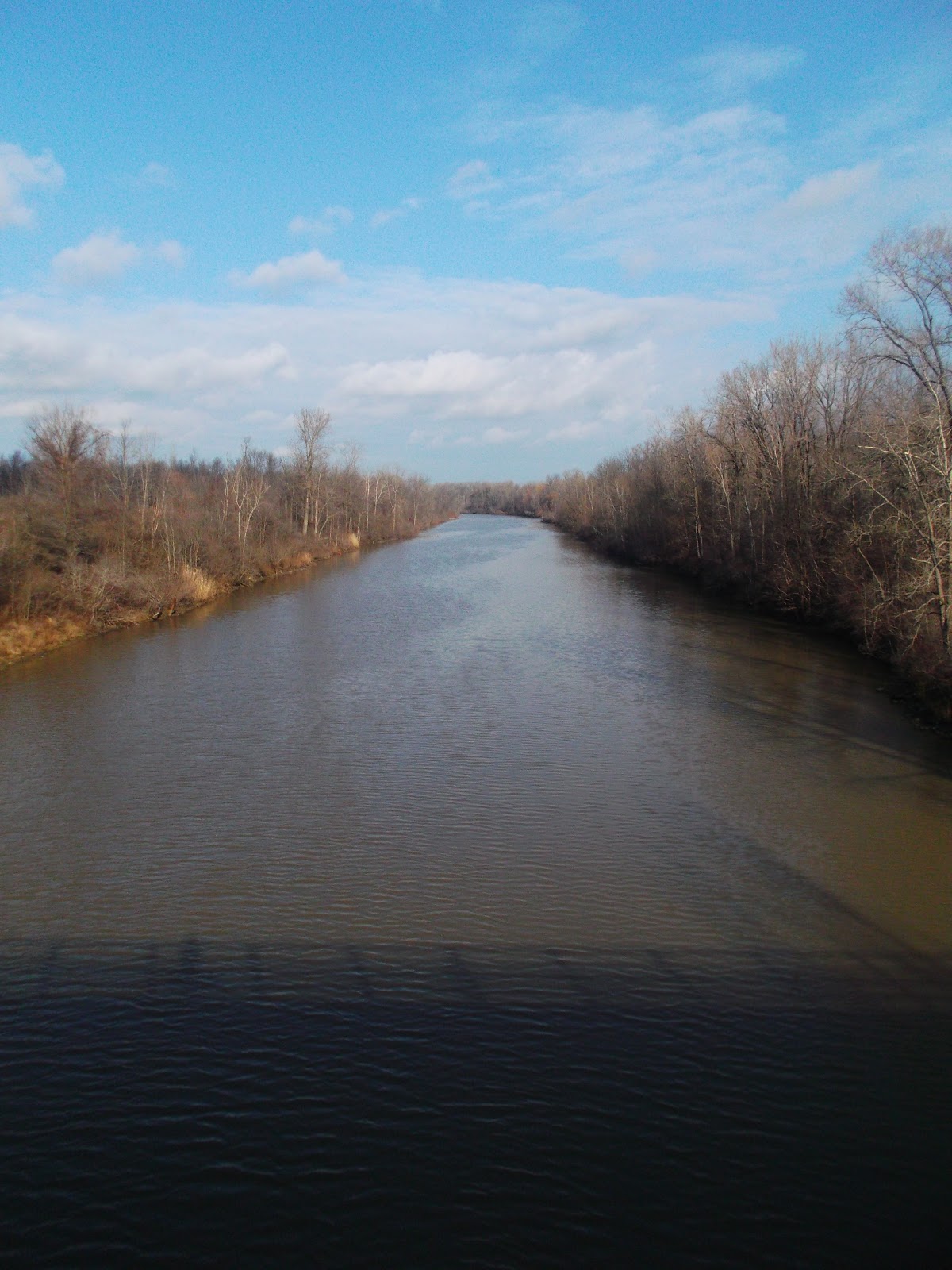
Once again I tread the familiar Riverwalk (not going through the city to Amy's Place for breakfast as I wanted, being too late), heading north towards Tonawanda Creek, the last leg of the old Erie Canal journey before Buffalo. A light snow had begun to fall, finally, I get some of the white stuff I traveled across the country to see. Luckily though it wasn't a blizzard and by the time I hit the Tonawanda Creek, the snow had dissipated.

The Tonawanda Creek path in Amherst.
Empty pathways in the cold.
My first look at the manufactured section of the canal.

After about an hour and a half on the road I was jogging along fairly nicely with a decent tailwind. The bike path was fairly clear and dry and swerved back and forth, then a wet corner struck. I leaned into the corner and my wheels slipped out from under me and I went down hard. Less than two hours in and I already found myself on the ground. My right wrist and knee took the brunt of it, but after taking a second to check myself out, I was fine. My bike on the other hand needed a little love, my brake levers were pointing inward. But I was prepared and pulled out my tools and fixed that up too. From there on out I took the corners much more timidly.

Niagara Produce in Lockport
The last lock of three in Lockport, I should have gotten a better picture of all three, oh well.

I reached Lockport around noonish and grabbed some food from a supermarket, this is my first vegan tour so it would be interesting to see how eating would be. I passed a Subway, a vegan fast food staple, but figured that to be a last ditch effort, instead I found Niagara Produce, a nice little produce market and deli. I grabbed some fruit and some trail mix, I suppose this would be my future tour compromise, living by markets instead of fast food, probably for the better anyway.

Middleport
Medina 
Waterfall behind Medina.

From Lockport the towpath began. I was now on gravel, which oddly enough made me more confident about staying upright. The canal path looked about the same all along, not changing much. Middleport was the first town I hit, I checked it out found a nice coffee shop, considered coffee, but since I had just stopped in Lockport I decided to press on, figuring the next town would most likely have coffee as well. How wrong I was. I somehow circumvented the Medina downtown and watched the Main St pass by from across the marina. The next few towns were tiny little towns that lacked any sort of business district. Albion was my only hope. I recognized the name (as I had with Medina) so I figured it would be a larger settlement. As I approached Albion I looked across the canal and realized why I recognized the name, on the south side of the canal was a large institutional brick building behind a series of chainlink fences, the last topped with razor wire. That's why I know the name, Albion State Prison. It's strange to think how this could make a town recognizable. The downtown was fairly large compared to the others passed, the largest actually I've seen on the canal (besides Lockport), but it was empty. Two blocks long and one block wide crowded with storefronts lying vacant. Albion was a bust as well.

Along the path were a lot of wide open grassy fields like this one.
I was so excited to reach Albion.
All these shops made me hopeful. False hope
By Albion I was forty miles from Lockport with no stop and my toes were starting to get icy. My feet felt like ice blocks just spinning dead weight in my toe clips. I kept spinning and passed the tiny towns of Holley and Eagle Harbor, seeing no sign of any commercial life, I just kept  going. Once I reached Brockport the sun was nearing the horizon, I decided to skip Brockport too, in hopes of reaching Rochester before nightfall.

Brockport turning on their lights before I was even finished.
I didn't. The sun was down as I crossed into the suburb of Gates, where I reentered the roadways. I stopped first at Wegman's a regional (and awesome) supermarket where I feasted on the hot bar (vegan friendly) before meeting up with my friends Mike and Sam. Even just walking off the bike for a couple minutes and getting some food in me made me feel better and riding the two miles from the supermarket to my friends' apartment I rode out of my saddle happy to put the first day behind. Day one was a series of lessons learned, leave early to get enough sunlight and stop for lunch. Two days off in Rochester before my next day of riding to Syracuse.


Thursday, December 13, 2012

Prologue: Niagara Falls


Before I came to Buffalo, I had planned a handful of rides I wanted to revisit, like ride up to Niagara Falls, or head down to the Boston Hills, or maybe even ride to South Buffalo and drink a pint in one of the Irish pubs. Then once here I became too busy to ride all over the place (I also wasted my first day in town thanks to a bone chilling rain). With only one day left in Buffalo, I forced myself to squeeze in one of these rides, so I ventured forth through the chilly weather up to Niagara Falls.

The highway and the creek.
I'm sure this matches some weird modern house somewhere.
That old industrial space was once a failed attempt at hip found space living.
The sun was way more apparent looking in this direction
I started off from the Wegman's on Amherst St. in Black Rock, to get a quick light lunch before taking off. Behind Black Rock along the Scajaquada Creek is a bike path connecting Delaware Park to the Riverwalk along the creek. Underneath the Scajaquad highway, which the city nonsensically built (I doubt it saves anyone any time really while destroying the natural streetscape and also impeding on Buffalo's treasured Delaware Park, leaving no Olmsted Park untouched by a highway now), there a bike path along the heavily polluted Scajaquada Creek (unfortunate but true) next to some old industrial brownspace, left from when the International Railroad Bridge used to bring a heavy transport industry to this part of town (now lost to the over-trafficked Peace Bridge). The path has a very unique character, that I find fits Buffalo very well. A quaint creek hidden underneath a highway surrounded by decrepit industry, any fan of urban exploring or intrigued by the oddly magnificent views of urban decay should not pass up this little path.

Riverwalk bridges.
Grand Island bridges.
The view from the bridge.
After the Scaj Path, I returned to the Riverwalk (which you can read about more in my earlier post) towards the Grand Island Bridge. The Grand Island Bridges are still terrifying to ride across (which I guess is why they suggest you walk over the bridge), but the apex gives a stunning view of the Niagara River (strait!) at it's widest point, which makes it almost worth crossing. Dropping over into Grand Island I got that strange sense of what this place could have been, a feeling I get every time I am here. Grand Island is a strange sort of development, where everything is built about a mile apart, leaving large vacant lots between buildings. Some of these lots are raised for "shovel-ready" sites while others remain wooded. It's these wooded lots that make me wonder what Grand Island could have been. I imagine that no one ever built a home here, that the 190 bridges were never built and this island was one huge preserve only accessible by ferry. Unfortunately this isn't the case, so I just kept my head down and rode passed the big ugly strip mall lined road occupied by high speed traffic. Right before the north bridge, leaving the river island, there is a huge swath of protected swamp land (my favorite thing America does, by protecting land that cannot be built on as a preserve, but I digress) which is absolutely beautiful and makes me sad for this vision of what Grand Island could have been.

Where does this go?
A path I found nearpl the north bridge of Grand Island.
Niagara Falls peering through the bridge.
Playing with the timer on my camera.
The bike at the swamps.
Heading towards Niagara Falls (after getting lost a little, they really need to sign these bike paths better) I became disillusioned again by Western NY's failure at protecting something beautiful. A few miles out from one of the natural wonders of the world are some of the ugliest chemical factories in this country has to offer. Looking across at the quaint Niagara Parkway on the Canadian side I listened to a chemical plant unleash steam at such high pressure it sounded like a jet plane, only amplified by the sound of the US Interstate traffic whizzing by. This path has some nice qualities, especially as the sun was reflecting off the river, but this places feels like it could have been saved but was lost to more failed policy. I never understood why a place with such a beautiful natural attraction needed chemical plants to supplement their job base (I am aware that the cheap power had part to do with this, which oddly enough now that hydro power is sent to New York City, another silly thing about this place).

The Northern Grand Island bridges.
I actually bought the blue Cross-Check to match these bridges.
As much as I hate all this development in Niagara Falls, it's the lack of development near the actual Niagara Falls that makes the American side nicer than the Canadian side. I rode along the paths, devoid of the usual tourists, to Goat Island, the island between the Horseshoe Falls and Bridal Veil Falls. Here on Goat Island there is a small gift shop, a restaurant, and a parking lot, but other than that, there is a good amount of green space that allows getting right next to the river as it heads over the escarpment to drop 160' down to the bottom. Compared to the Canadian side, which I also visited and was also empty of tourists (I don't think I've ever seen Niagara Falls this empty, even in the winter), which is bricked over next to the falls and has a much bigger visitor center with kitchey gifts and knick-knacks. The American side feels more akin to what this should be, a natural experience for a natural wonder.


The Niagara River.
This reminds me of a story a co-worker once told me of an acquaintance losing his engine and anchor around this point and deciding to polish off the rest of his 30 rack before help arrived.
After seeing Niagara Falls again (which was more wonderful after not seeing it for a while), I rode down the Niagara Parkway back to Fort Erie towards the Peace Bridge. To continue the country comparison, Niagara, ON is doing much better at preserving their water front along the river. Niagara Parkway is a residential neighborhood with beautiful homes (a lot for sale) and a peaceful winding bike path. I've always preferred this way to or from Niagara Falls than either the Grand Island or Riverwalk ways on the American side. The sun was beginning it's descent down so I didn't take as many pictures going back, as I wanted to beat the sunset, but the creeks that let out to the river are idyllic spots that are just screaming to be put into watercolors and the undeveloped grass fields have a similar pastoral quality to them. I wish I wasn't in such a hurry to get back so I could take some pictures of these nice little spots.

Niagara Parkway grasslands, this is actually the site of the Chippewa Creek Battle of the War of 1812. It's strange to think how deadly this boundary was 200 years ago.
By the time I reached Fort Erie, my feet were frozen and the sun was down. Crossing the Peace Bridge I was hoping for a beautiful view of the Buffalo skyline, but was given none (the view from the park just below the Peace Bridge in Canada gives a good view for those looking for one, but mostly because the artistic City Hall is the foreground and the HSBC Tower is far enough to not look ugly), instead I could just make out some of the taller buildings lights, but nothing coherent. The bridge on the other hand lit up in green and red for the holidays was quite nice, it amazes me how much better this bridge looks lit up than in the daylight hours.

With my last day over in Buffalo, I was prepped for tour, leaving for Rochester the following morning.


Sunday, December 9, 2012

One Last Commute, Buffalo


I haven't updated in about a week, mostly because my long stint of unemployment sadly came to an end. But there is good news, my exciting new stint of unemployment begins today. Part of the plan for this bike tour across New York state was working at my old job at the Center for the Arts at the University at Buffalo, doing silly things like getting underneath a bed with wheels and pushing it across stage.

I've had some help with staying on some couches while I'm here. Right now I am staying at my friend Brian's, in Allentown which is right near my old haunts in the West Side of Buffalo. Being so close to where I used to live, I decided to reminisce a little and take the Riverwalk from the city to the University at Buffalo (which isn't at Buffalo at all).

The Riverwalk is a series of bike paths and bike ways running from downtown Buffalo all the way up to Niagara Falls (it may actually extend further, I'm not sure where the Seaway Trail begins and ends and becomes the Riverwalk). When I first started bike riding this was one of the first places I explored, hopping down the bike path of UB to Tonawanda and along the Niagara River (which is actually not a river at all but a strait), both north to the Falls or south to the Queen City proper. Then once I moved into the west side, I would take this path system  in the reverse direction going back along the Eliccott Creek to the north campus of UB.

I picked the worst day to do this ride. My call wasn't until 11 30, so I figured that it would be nice to take that extra time to ride to work along the more scenic direction (adding an extra five miles as opposed to through the city). When I woke up, I looked and saw a drizzle coming down and had a decision to make, to add the five miles? Or to even subtract some mileage taking the subway and bus to north campus. Just as I was contemplating the rain seemed to break a little, I took it as a sign to go to the Riverwalk.

It was a misled sign. As soon as I was committed, turning onto the bike path off Porter Ave, near the Peace Bridge ramp, it began to rain once more. No point in turning back then. The path was the same as always, the gaping cracks still existed near the Treatment Plant on Squaw Island, the border patrol SUV was still sitting near the International Railroad Bridge, and roots seemed to come up around every corner. Despite these poor conditions, both meteorological and pavement wise, it was nice to be back along the path, passing some of Buffalo's history.

The bike path near Porter Ave.
Looking back at the Peace Bridge.
Leaving Squaw Island over the old canal section near the Black Rock lock.
You are looking at the I 90 and 198 interchange, a sort of beautiful mess of concrete.
A section of the path was closed, right near the boat ramp and parking lot near the low-income housing towers (which I always found strange since I'd love to live on a high rise right on the water). That meant I had to get back into the streets. Surprisingly, the City of Buffalo had added a new bike lane, to a place that didn't really need one (Main St, near South Campus of UB is still a major death trap), I guess ill-advised progress is better than no progress. Near Riverside Park I took the pedestrian bridge back over to the Riverwalk.

This section of Riverwalk has always felt a little claustrophobic, which is why I never rode it at night. On my left were the currents of Niagara River and to my right the currents of automobile traffic. The next exit wasn't until I crossed into Tonowanda, I always imagined that this path would be full of misguided youth looking to pick off some poor sucker riding alone at night (Riverside is not exactly the most comfortable neighborhood to be in at night). The good thing here is that the path is flat and smooth, I hammered through the steady headwind that seems to always hit, no matter what time of day or direction (I forgot how bad the winds were here).

Into Tonawanda civilization dropped out for a bit heading into the chemical waste zone near the Tonawanda Coke Factory (a constantly supervised plant for poisoning Buffalo's air and water supply), the Tonawanda Power Plant (I believe a coal burning plant), and some NOCO oil refineries. Surprisingly, despite these obvious blights, this is one of my favorite sections of the bike path. Here, between the city of Buffalo and city of Tonawanda, everything is much more spread out. In front of the giant looming red brick power plant are extensive lawns and parking lots, beyond the gates of NOCO are rolling green hills. Instead of a crowded vertical, here everything is an open horizontal. Plus the river seems prettiest here.

The path is surprisingly colorful this late in the year, everything should be white by now. 
The power plant in Tonawanda.

Beyond this open section, the path turns into Niawanda Park in the city of Tonawanda, which in the summer time means, time to dodge the elderly, kids on bikes, and dogwalkers, luckily it was 50 degrees and raining, so it's only dogs this day, and there were few there. Niagara St. is elevated at this point, so traffic is hidden up on top of a rapid rise, instead all I see are bare oaks and picnic tables along the green grass of the park. In the summer these trees are beautiful with leaves and the sun is always warm here, but riding it in the cloudy rain, it just felt gloomy.

A quick pass through Tonawanda (another old dying town in Western NY, but doing better than Buffalo, drawing in the suburban sprawl, even though it's just as old as Buffalo itself) and I was on the creek towards Buffalo. I really love the creek systems in Tonawanda and surrounding areas on how they split off, as Niagara River leads into Tonawanda Creek, Tonawanda Creek splits right away near the city's center to Two-Mile Creek, then a few miles down the road, it splits once more into Elicott Creek. Tonawanda Creek was once part of the Erie Canal System, one of the few existing waterways before the canal was built. Once I made it to Elicott Creek Park, where the two creeks split, I got off the old Erie Canal track and headed to work.

Tonawanda.


Two Mile Creek, that's a pedestrian only bridge.

UB Bike Path.

Elicott Creek.
Taking 45 minutes longer than usual and being completely soaked (but taking pictures probably added more time than anything else), I had made it to work. Maybe riding in the rain was a poor decision, but it was nice to see the old ride I would do to work. I really just hope the rain will let up in the next couple of days, because this planned snow tour isn't so bad, but a constant 40 degree rain might mean canceling the ride.