Wednesday, January 30, 2013

Finally, I'm Back, or Finally, Single Track


Well, here it is, my first post in a good couple of weeks. After my vacation in Florida, my life has been in that strange, weird, stressful cousin of vacation called unemployment, and like a vacation I wasn't living in my own place, I was essentially homeless for a bit there (hopping from couch to couch). But one thing turned around, I found a great place in North Oakland, but unfortunately, the job thing hasn't been going so great. After spending one day begging people for money (i.e. canvassing), I quit. And when I quit I let out my disappointment and rage into the pedals, riding like a psychotic messenger, weaving in and out of cars as I raced top speed through lights. Luckily, I made it home alive and spent the rest of the day as I've spent my last month here in Oakland, filling out job applications.

If you ever want to know what desperation feels like work a day canvassing with a near goose egg in your bank account, woof. All this job garbage has really gotten me losing hair, worrying about rent, or food, or what have you, but there is one fall proof plan to make me feel better, get on the bike and go.

I've been planning on replacing my 40 mm Schwalbe Marathon Mondial's for something a little slimmer (my 28 mm Marathon is still kicking all the way from Chicago, so I want to match that). I've been leaning towards the Vittoria Randonneur Trail, but that's a story for another time. The point is that with those wide nobby tires I should hit trail before I can afford to change them (although I will certainly hang on to these fatty's for some trail touring in the summer hopefully).

Turkeys!
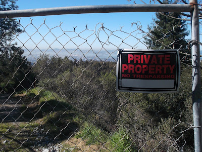
This is a political statement about the city and death of public place. Or it's a picture of Oakland through a  fence.
Marin County may be the  beginning for mountain biking, meaning single track left and right and bike access to nearly every trail. East Bay on the other hand, full of those granola munching hippies from Berkeley, fight to keep steel and aluminum off their trails (even the fire roads in Berkeley don't allow bikes). There are some exceptions when you get beyond the hills, but in the hills there is only one place to go for single track, Joaquin Miller. I was inspired by this video, so I set out for the Cinderella Trail.
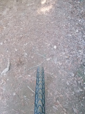
Rubber on dirt.
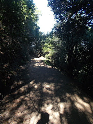
West Ridge Trail, so shady.
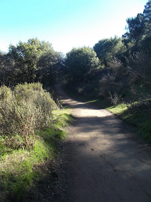
Pretty wide fire roads for the most part in Redwoods Regional Park.
I had to get there first. Living somewhere new means a new way into the Hills, a sort of nice way. It doesn't seem as quick coming from West Oakland, unfortunately, but I no longer have to contend with Broadway Terrace, but instead get Tunnel Rd, right away, both old and new, plus Tunnel Rd. has a dedicated bike lane with a roomy buffer zone. Getting into the climb I remembered how much I adore Old Tunnel Rd. mashing my lower gears towards the top with an aggressive cadence, as opposed to grueling out those gears on Claremont or Centennial Dr. Once up top it was the fire roads of Redwoods Regional to get to the other side, where Joaquin Miller is. The fire roads of the West Ridge Trail were fun, but they seemed to only be a prelude for what was to come.

I can see something that can see a lot more than I can.
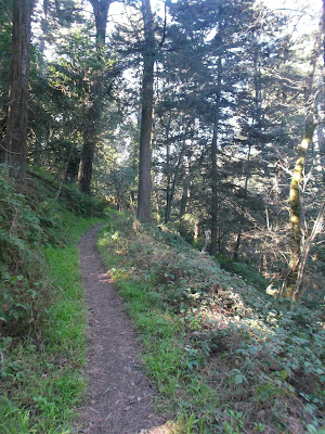
Single Track!
The West Ridge Trail doesn't necessarily end at the Chabot Space Center, but that's where I quit it. This was where I dropped down from the telescopes toward Joaquin Miller, the sprawling track that rings freedom for bikes. I wasn't sure of the directions of the trail systems, but I was apparently on Castle Trail. On this trail it was beautiful single track. I dashed in and out, the trail dropped (most of Joaquin Miller is on the slopes of the hill, not rounded around the top like most others) and I kept squeezing my breaks in my drops to keep a hold of the bike. If you noticed in that video they had real mountain bikes and full on face protecting headgear, I was on a cross bike with a regular road helmet, yikes. This could be dumb. But I pressed on. I almost lost my tire once in a water divet, thankfully I stayed calm and carried the rear right on through. First day back in single track and no scars to account for.
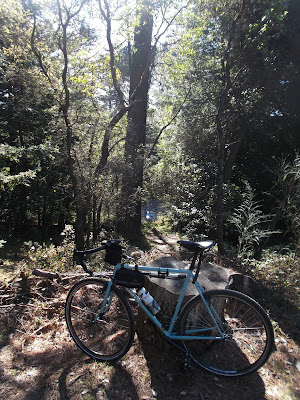
The blue matches the forest well.
Castle Trail eventually becomes unrideable.
Castle Trail let out to Castle Drive, a descent that seemed like it could be a blast if I knew it, but being new it was mostly brake hugging the whole time. Once out it was back through Montclair down into that weird Berkeley and Oakland border (like really they couldn't just pick one road?) across town back to North Oakland for a brilliant day back on the bike and my first time on single track since I was maybe 14.


Tuesday, January 8, 2013

Long Island Riding


The snow didn't come until I was long gone from the state of New York, but that didn't mean I kept off the bike when I was at my parent's house on Long Island. I've been dreaming up all these big huge rides to do from their house, located nearly dead smack in the middle of the island, one ride going to the Eastern end and staring off from the end of Montauk (although this would be much better in the summer time with a camping trip), the other going west and crossing the historic Brooklyn Bridge. Unfortunately, I didn't budget my time well enough (or I prioritized other things like a Jets game with my brother and seeing an old friend in Brooklyn) and missed out on both of these rides, so instead I just settled on shorter rides around central Suffolk County.

There are so many trees here, I wonder what it looked like before NYC grew into it.
One of the few and far between bike paths.
Most county parks are donated estates, such as this one hiding behind the trees and lake.
I was not really into cycling growing up (much to the chagrin of my father), it wasn't until I spent my first summer in Buffalo that I realized I could get anywhere I wanted by bicycle in the urban areas, then from there I learned the joys of getting out of the city by two wheels. This love for the closeness of the urban and love of the solitude of the country makes the sprawling suburbs of Long Island a seeming death trap for cycling. I haven't really lived on Long Island with a bicycle much, only spending a week with a bike before my cross-country trip, this would be my second considerable time riding around the island.

Bikeway bridge next to Sunrise Highway, there are a lot of these transportation barriers, between  hardly named rivers and highways.
So there are some nice parts.


The rare urban shot on Long Island. This is Islip village, the South Shore villages dotted along Montauk Highway are actually sort of nice, I even had lunch at a decent vegetarian Chinese place when I took this shot.

South Haven County Park.
I was expecting much less friendly roads, but oddly enough in more carcentric places, shoulders tend to be wider, as they were planned around cars I suppose. One of my first rides was to Bellport to see the bay (which was creeping up on the park) and most of the riding was on quiet back streets and crowded county highways with giant shoulders, while filled with debris, they were very safe giving me plenty of room to ride away from traffic, only turning lanes would become hairy, but no one seemed to cut me off or mind me properly signaling into the road, which was a surprise, maybe they were just surprised to see a bike in that frigid weather (although the lycra covered roadies were making their rounds on Sunday).

Most reserves are pine reserves, where are the oak or maple reserves? Pines think they are so special.
The steed.
These paths seemed so tempting, but right next to this was a  "Hunting in Progress" sign, uh, no thanks.
Cool old single lane bridge.
I made a second trip to the bay through Patchogue, which was just as nice, but two other rides I did were to two preserves, one being Southhaven County Park and the other Rocky Point Natural Resources Management Area, both were in hunting season and closed to mountain biking unfortunately (I did like mountain biking as a kid and Rocky Point was a favorite weekend spot), instead I tried communing with nature by looping the parks. Southhaven was only partially nice, two sides of the park were quiet residential roads covered with a fence obscuring the view of the forest, which was sad, but the lack of traffic made it worthwhile. Rocky Point on the other hand was crap. Only one side didn't have a lot of traffic, and lacking a fence was nice to feel like I was right in the forest, but even on this road there was no shoulder and traffic moved far too fast. I didn't feel safe on any sides of this park unfortunately.

The encroaching bay.
If only I had fat tires for that sand.
Clear roadways.
This is what I ride for.
Urban bike riding has been a rapid investment with most cities buying in heavily, but suburban cycling has been a slow progress. For the most part cycling is still seen as recreation only and recreation cyclists who ride every now and then seem more willing to deal without cycling lanes than those who ride dangerous roads every day. Long Island needs some help, even the new bike lanes seem in odd places and there for the wrong reasons, like the one on Woodside Ave near my parents' house, which was put in as a traffic slowing measure (shrinking two lanes to one in a wide road, which still allows for fast traffic as most drivers drive slow on visually smaller roads, not less laned roadways). Then once you got to the end of Woodside the lane just stops instead of connecting Medford to Patchogue down Route 112 (even some sharrows might help). But, the suburbs were built on cars and designed for people who want them, so for now I'll keep out, maybe missing the ride to Montauk and Brookyln aren't so bad.

Wednesday, December 19, 2012

Day 5: Syracuse to Failure.


My hosts Casey and Rei in Syracuse, were incredibly gracious. I've yet to have a bad experience through Warm Showers (and this is stay number 4). In the morning they made me some oatmeal and some delicious coffee, which really hit the spot. When I stepped out the front door, rain started coming down, my biggest fear of tour. It was a light drizzle and seemed to be slowing down. As I left, the flags were pointing straight to the Pacific Coast as I headed towards the Atlantic, right there I knew it was going to be tough.

Morning, canal.
Goose!

The morning wasn't terrible, but it wasn't great. The air temperature had risen at first and as I had expected the rain eventually disappeared, but the head wind did not. I pushed forward through more desolate farmland of Central NY. It's surprising how the further east I go, getting closer to the crowded Hudson and the endless endless sprawl of NYC, things actually ended up seeming less built up. I passed through the tiny canal town of Canastota where I called my host for that night and tried out some handwarmers that Casey and Rei had donated to my trip, I tried to get them on before my toes and fingers got too cold.

A fort in Rome, NY.
The garrison.

That was the last good memory of this tour. The beautiful isolation from townships and cars continued, but the wind was defeating my spirit and the rain absolutely killed it. About 20 miles outside of Rome, my legs were feeling the 90 miles the day before and the force to keep around 12 MPH in the wind was wearing them thin. I avoided the path from there on out, hoping the pavement would help me keep up my speed, but once it started pouring on me, I knew this was it. I didn't want to call it quits, but at this point I was soaked and the wind was ripping through my leg warmers and the hand warmers were not doing what they were supposed to. I hated calling it quits, but it was 60 miles to my hosts' house that night. I considered the possibility of adding another day, but that would have added several hotel stays, which rapidly increases the cost of the trip, plus the rain was now dipping the temperature in that danger zone of 35 degree rain, frigidly cold and dangerously wet. I just knew I had to quit. I pulled into a Subway, the first vegan friendly spot I saw, and called it in to my host and my mom. I'd hope to catch a train in Rome. Due to some struggles with getting my bike on the train, I ended up having to take a Greyhound from Utica, but I finished the night at 3 AM in my childhood bedroom on Long Island. Erie Canal Tour over.

Last view of the canal.
Last bridge over the canal.

Quitting felt weak, but honestly, sometimes you have to know when to end it and it was obvious at that point. I arrived at Utica at 4 PM, with the sun almost down and another 40 miles to go to my hosts that night, which meant I would  be in the dark for at least 3 hours, which sounded scary and unfun. It's easy for me to say that it was the weather that made me quit, but that's not true, I was actually hoping for worse weather and snow, the problem was planning 90 mile days in 8 hours of daylight. During my summer tour, doing 90 mile days was not that hard, but I was also taking long breaks midday, which I could not afford to do now with significantly shorter days. Plus, avoiding those long breaks meant I wasn't seeing much, was it really worth it to ride 90 miles a day and then pass out exhausted and cold? I really didn't think so. Being defeated has me only antsy for what tour I should do next. I'm looking forward to going back to the Bay Area and hopefully bike camping sometime soon.


Tuesday, December 18, 2012

Day 4: Rochester to Syracuse


After a few days of R 'n R with old college friends in Rochester, it was time to hit the road again. It wasn't far from my friend's house to the path in Pittsford, once on the path it was the same as the first day, the same gravel towpath and the canal had the same width. Even though things looked the same, I was enjoying being on the path, mostly because it was so quiet, no traffic to speak of.

Pittsfield, NY. Said to walk my bike, but with no peds, why bother? I'm a rebel, I know.
The same old path.
After Palmyra, when I was figuring for a snack, I saw two ladies walking along the path, fumbling with my Cliff Bar I was able to shove it in my jacket pocket and call out my pass. I passed no problem, but then I went to continue with my Cliff Bar and this was where things got hectic. Reaching into my pocket I pulled out a glove, my MP3 player, my headphones, and my food. Grabbing too many things, I struggled to keep them in my hands. Diverting my attention from the road to the objects in my hand I began veering right. I tried to regain control, but it was too late, I was off the path and squeezing my brakes. In slow motion I watched my tire slowly roll into a log on the side of the path and I went over my handlebars.

Glad I didn't fall into any mud or water, that would have been a one way ticket to cold.
Shortly after the crash, the steed survived of course.
I was fine, but being childish I swore a bit at the bike and threw my helmet. I was okay, the only thing to get hurt was my headphones, one of them ripping off in my ear, which I suppose things could have been worse. Still, second day of riding on this tour and the second day I ended up on the ground. After this crash, I began to get down on myself a little bit. I was frustrated at falling and feeling a little worn out from spending all day in the saddle, with no time to enjoy off then bike. But as I tried to convince myself to continue the tour, the path changed from the same old to something novel. Before I reached Lyons outside of Palmyra, the leaf covered path began to bob up and down, breaking the monotony of the flat path. This gentle change in riding  began me thinking of the possibly cross racing next season and I embraced the small rolls on the path and pushed a hard pace forward. This was enough to keep me happy all the way to Lyons.

Rolling foliage.

Swamps along the canal.
Locks outside of Lyons.
Then Lyons improved my demeanor even more. Pulling into town the town center seemed small and hardly existent, but I was here and about halfway done for the day, so I decided it was lunch time. I putted around for a bit looking for someone to ask and the only person, instead someone found me. Baldy Bob was his name and he greeted boats coming along the canal in the summer time. He informed me of how the Erie Canal Bikeway is actually a fairly popular touring route in the summer, because of this Bob had met some cyclists over the years and took their pictures to post on the Lyon's community blog. He snapped my photo and gave a short history of the town, of how the canal used to run right through town, akin to how US highways run through small Midwestern towns now, the canal climbed behind the main street (now a parking lot). He also told of how Lyons gained it's notoriety, once being the world's largest peppermint exporter in the mid 19th c. People like Bob make the road worth being on. He suggested a little diner, which was very little, and due to my new vegan diet, I only had a roll and some homefries, a sad lunch indeed.

Downtown Lyons.
Baldy Bob, displaying the steed.
The bridge at Lyons.
Beyond Lyons the towpath ended. I was now traveling along Bike Route 5, a cross-state bikeway (one of three, I don't know why the numbers are so far apart, but 17 goes across the southern tier and 11 goes up into the Adirondacks). I never thought I'd say it, but bless the interstates, because NY 31 between Rochester and Syracuse seemed very untraveled, I rarely met a car on the wide shouldered road going east. I popped over a few hills and ended up marveling at the swamps surrounding the Seneca River. There was a park along the West bank of the River with a mud laden road I wish I had time to explore, but unfortunately the little amount of sunlight and an over ambitious daily mileage meant I had to keep going.

Repair boats outside Lyons, nice Empire State Blue and Gold.
There was a lot of wilderness surrounding the trail, so quiet, I love it.
An old aqueduct outside Syracuse.
After a quick stop at Port Byron, where I took some light ribbing from some comical truckers, I began the last twenty mile bit into the city center of Syracuse. I abandoned the canalway prematurely, turning off around Weedsport to get on State Highway 5 for a straight shot into the city center. This was a bad idea. Not only did 5 turn into a freeway at one point (no bikes allowed) meaning I had to reroute, but the road also had some hills I was forced to battle. I was greeted with some encouraging honks (first ones of tour), but it wasn't enough to make me forget the struggles of pressing upward. Then once I began the descents the sun started doing the same, making those rapid descents chilly. By the time I reached Camillus on the outskirts of Syracuse, I was ready to quit. The last section into Syracuse was not exactly worth seeing either. A four lane highway shouldered by large parking lotted strip malls and big box stores, basically what I now refer to, and always will refer to, as the buttholes of America (I never understood these places, but a lot of people find them very enjoyable, to each their own I suppose).

The path going towards Syracuse, it was very rural here.
Bare leaved trees and swamps, not exactly the white path I was hoping, but still the change in  seasons makes NY so different in winter.
Distant hills, being on mountain tops, these hills look pretty weak from this height, but still Central NY is rollin'.
I avoided traffic and ended up in downtown Syracuse in Clinton Square, where the canal used to cut right through the heart of downtown Syracuse (the commercial route now diverts far north of the city). Downtown Syracuse was actually pretty quaint too, with similar well lit antiquated buildings as Buffalo and Rochester with a nice downtown public skating rink (like it's fellow canal cities to the west). It wasn't much further til I reached my Warmshowers hosts' house, where we swapped stories over dinner and some beers. It was another high mileage day completed in a hearty headwind with some hills thrown in, I wasn't really sure of how many more of those days I could put in.