Friday, November 16, 2012

Three Bears Ride


A classic East Bay ride. Almost every roadie who has matched pace with me for a chat while climbing has mentioned this one "Have you done the Tree Bears yet?", I always answered no. Little did I know I should have answered yes. When I got to the Bay Area I went into a great rest period of two weeks, no padded shorts, no jerseys, no non-commuting rides. After this hibernation my first ride was actually a semi-sort-of commute ride. At the time I was volunteering for the John Muir National Historic Site in Martinez, CA, I would then ride the thirty miles back to Oakland.

The ride was along Alahambra Valley Road, then over Bear Creek Road. I remember the rough rolling hills that eventually would lead to the final climb of Wildcat Canyon Road. After the steep grades of Papa Bear, I took a liking to Wildcat's gentler climb. Then I'd drop back home to Oakland.

I didn't realize this until I actually looked up what the Three Bears actually was. I assumed it would have something to do with Grizzly Peak, but they didn't. Three Bears is a combination of three hills along Bear Creek Road. Mama Bear, Papa Bear, and Baby Bear. I decided today I'd do this road strictly as a day ride.

After descending Wildcat Canyon Road I bore left along San Pablo Dam Road. I circled the Reservoir, giving some nice views of the crystal clear water that I'd probably end up drinking at some point (this was one of the East Bay's drinking sources, which is also why it's fenced off almost completely). Once the reservoir ended the loop continued around the reservoir turning right on Castro Ranch Road and then followed down Alahamabra Valley Road, a section after the intersection of Bear Creek from Martinez, this was all new territory for me.

Looking over Berkeley from Old Tunnel Road.
The San Pablo Reservoir.

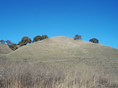
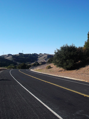
This section of the ride had me stopping all too much for photographs. It was what I thought California should look like. The California that Steinbeck wrote about, the one before LA and San Francisco were all us East Coaster thought about, a different kind of California one full of open ranches, rolling brown hills, water starved trees, and wire fences, the California Okies found in 1932. One part of this road especially struck me where the road slopes down right before the intersection of these two roads. The gentle down grade gives the eye the advantage of looking over the freshly paved road with telephone poles neatly arranged next to a hill that has been evenly shaped by the winds of time.

I could stop and take pictures all day of these ranching roads.
More shots of the hills on Alahambra Valley Road.
Some day I'll learn how to capture this on a pad with pencil, but for now, digital photography works.

Quickly on Alahambra Valley Road, the macro turned to micro. Now a small creek jogged beside me with trees hugging the banks, giving the creek a relaxing look, a place I'd expect to find some cliche of Tom Sawyer catching frogs. I stopped again to snap some photos, that still were unable to grasp the picturesque quality of this spot. Part of me wanted to stop drop a line in the creek and take a nap, but no time for that.

Crowded trees hid open fields.
Brambles created from an actual water source.
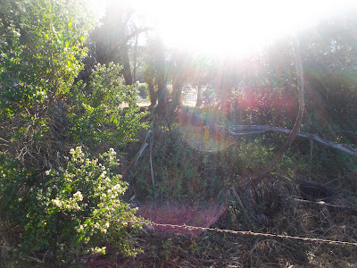
I couldn't get over the way the sun was sneaking through the trees here.
Then from Alahambra Valley Road I returned to the route I knew, Bear Creek Road. Time to settle in for the ride, no more photos. Mama Bear is a straight climb, not a back breaker of a grade, but not a walk in the park. I like the fact that I can look straight up to the summit and just keep my eye on the vanishing point, as I settle into a cadence. It was an enjoyable climb, just to keep pushing and watching the crest get closer, and before I knew it, I was over it.

The descent to Papa Bear is a fun one, full of rolling hills that eventually roll right into the climb of Papa Bear. Nearing a mile long, this one is not so friendly. The road is painted with encouragement for cyclists, I wonder if this was for a race, or if some obsessed roadie spends his weekends spray painting words of encouragement on the road ways (either way, I'd like to shake his hand). Papa Bear is also not as steep as some other East Bay roads, but it's length is what gives it grit. Like Mama Bear, the final section is straight up, which allowed me to time my energy consumption. Unfortunately, there is less shade on Papa Bear, the sun baked through my jersey and I was sweating profusely, but I made it, crested and descended. One thing I don't like about these climbs, and maybe it has to do with the fact that I've ridden them before, is that they don't afford stunning views as the Oakland Hills, Diablo, and Tam do.
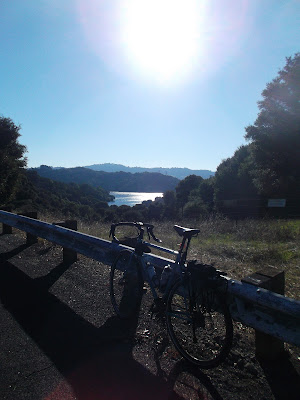
San Pablo Reservoir through the hills from the top of Mama Bear.
The descent to Papa Bear.

The descent from Papa Bear is an intense one. I probably clicked around 40 MPH around bends with some cracked roadways and gravelly shoulders. It sounds more terrifying than it is, it's actually a lot of fun to spin around these steep bends and then stand on my pedals over Baby Bear, the little climb before the intersection of San Pablo Dam road and Wildcat Canyon Road. Taking the Three Bears not as a commute, but a day ride is tougher and more fun, it's weird how the mentality of "getting there" and "being there" really changes a ride.


Monday, November 12, 2012

Let's Get Technical


Since beginning my foray into off-roading, I haven't done much technical riding. East Bay Regional Parks mountain biking is mostly old fire roads, rarely getting a chance to touch single track which split off the fire road in every direction along parks such as Redwoods. I completely understand this and am not complaining at all. As an avid hiker too, I would be very annoyed if I was hiking along and someone on a bike comes rocketing at me full speed.

Before the trail I found this sweet old fashioned looking utility building, reminded me of Buffalo/Niagara.
The East side of Old Tunnel Road before Quarry Road.

On my ride the other day, it started out that this was the same. From Grizzly Peak Blvd. I always eyed this road that went straight up the East Ridge, I was curious to find it. So after some Googling, I found it, Quarry Road. Part of the old quarry that is now Sibley Volcanic Regional Park, Quarry Road goes straight up the side of the West Ridge. It was a brutal ride up it, but once there I hopped along some fire road that was flat along the top of the ridge, but what is up, must go down. This was one of the most intense fire roads I've ridden since my experiments on gravel. Quarry Trail, a fire road as well, dropped down back to Quarry Road on a fairly shallow drop, but on gravel with a cliff to your left, this is a lot hairier than the incline leads to believe.

The West Ridge.
I guess these are the volcanoes?

Quarry road switchbacks, plus no traffic! Yum!


Then from there I was able to rocket down the wall that is Quarry Road. Now I was in the valley and had to find my way back up to the West side of the West Ridge, how to? From where I stood a trail led up to the Skyline Staging Area of Sibley Park, other than that, it meant backtracking, but why backtrack? I've got the tires why not?

The beginning of Skyline Trail.

This was no fire road. A single track that crossed dry and not so dry creek beds, bumping up and down over tree roots, this reminded me of the true mountain biking I did as a kid in Rocky Point. Going over technical bumps and popping over the trail, the trail decided it too wanted to go straight up. At first this wasn't so bad, but with the cover of trees dropping their fall foliage, as well as being wet, this meant my tire had nothing to grip on to. I hopped on the bike, pushed, but to my dismay the tire only spun, I put my foot down. I really wanted to prove I could ride this, tried it a few more times, but nope, wasn't happening.  I got out and carried the bike up this ridge.

Damn leaves!

I hopped back on, going through some more mud (no fenders this time, means no stopping!), but it wasn't long until up came again and this time mud was the culprit, Round Two of walking it up. Luckily this was the last defeat, from there on out I was able to grip some and push up to the Skyline staging area, almost a straight line up the ridge in shrouded single track that was totally worth the struggle for, and for once, it was an up that I'm more excited to go down than a down I'm excited to go up.


Thursday, November 8, 2012

Diablo Part Deux


I'm trying a new regiment of waking up early to ride, so I can have the rest of my day to bask in unemployment (this blog is quickly turning into an ode to not having a job). Today was my day set for a long ride though, so riding was the main focus. At 7 AM, my alarm went off. Rolling out of bed before I changed my mind, I rapidly threw on my jersey and shorts, grabbed an energy bar for breakfast, and hit the road.

Today was not about the Oakland Hills, so I'll spare the discussion of those roads I've written about on here incessantly. Nonetheless, I cut into Moraga, followed the Lafayette-Moraga trail into Walnut Creek, where it ends, not in Lafayette, like the name would suggest. From here I rode through the outdoor mall that is the WC. Beelined straight to where I want to go unlike last time.

It was cloudy in Oakland, but on the other side of the Hills, Pinehurst was sunny.
Lafayette-Moraga Trail.

Last time I ended up in this same spot, except my tires were 12 mm thinner and much smoother. Now I came prepped for the trail. Unlike the earlier mentioned bike path, the Briones-Mt Diablo Trail actually does connect the two places in its name. I headed west towards Diablo, growing larger and larger with every pedal stroke. The trail had some technical bits at first, including a straight drop down that was mostly jagged exposed rock. I bumped down it and then sped along on mostly hard packed Fire Roads. Diablo kept growing the closer I got. Eventually I was staring it right in the face from the top of one of Diablo's foothills. Erected base to summit, I could take it all in from that spot.

Mt. Diablo-Briones Trail, where I gave up last time.
The Diablo Foothills are surprisingly a lot higher than the towns below.
Forests are great, but the way the trees stand out so singularly here in the hills is pretty majestic.

It wasn't until I actually crossed into Diablo State Park that things truly revved up, literally, up. Coming out of Pine Canyon, the last drop on Burma Road before the climb back up Burma Road. Unfortunately my granny gear was giving me trouble (road riding with no added weight means I never use this gear), so I gave up and did something that would make any road rider sick, I pushed it. But today I'm no road rider. The hope is to make it all the way up to the top by trail.

40 mm Mondials at home on trail.
Cheating the weather, clouds over Oakland.
Pine Canyon

That was quickly defeated. Once I crossed pavement at the junction of Burma Road and North Gate Road the trail kept going up. 7 miles from that point to summit. I'd be there in no time at all. Well, 7 miles means the way the crow flies and that's their advantage, they can defy gravity, I can't. Burma Road was a wall. I've hardly seen hiking trails go up as steep as this one. I decided to get off and carry my bike up seeing if it levels out after this climb. I pushed with my toes, as the physics of it made it impossible to do otherwise. My calves burned and the grade stayed. There was no let down. This was it. Carry the bike to the summit or turn around and ride the road.

Well, frankly, riding sounded better. I almost felt like turning back with 30 miles in and about 10 of that on trail, but I was there, I should summit. Up I went. North Gate was the same road I took up last time, a no holds-bar, elevation busting, gut-wrenching, gear spinning climb. I settled in to my cadence and pressed on. I started around the 1,000 ft elevation thanks to the some bit of climbing on trail. The 2,000 mark didn't seem to come much later. I had my legs under me, for now.

Once I reached the junction my legs were starting to give a little, but hell, push through it. Since I couldn't summit by trail, my new goal was no stopping. Like most mountains, Diablo gets steeper closer to the top. After the junction I minimized out my middle ring (even though I did fix my granny gear on the road) and spun and spun and spun. I kept around 7 mph for the final 4.5. Just focusing on time not distance helped me over come the mental block, and before I knew it, it was my second summit of Diablo. I enjoyed the views, chatted with some folks doing the same, then began the descent.

The view from the top.

The descent was down South Gate as it let me out further West and I was hoping to ride home today, with not getting lost like last time. The South Gate descent was as fun as the North Gate descent, except a little more hair-raising. It reminded me of the last couple miles of the Big Horn descent in WY, where the road just drops off to nothing at times, meaning I hugged those brakes. I swooped around the bends and once the road flattened out I was in the town of Diablo, then turning due north through Danville and Alamo. With a dead GPS I didn't really know where I was, but I knew the hills to my left were the Oakland Hills, so I figured I'm heading north. Unfortunately, I was heading Northeast, so I ended up back in the WC. Not wanting  to get lost again with no GPS I grabbed BART back. 60 mile days before 4 PM aren't so bad anyway now are they?


The Unexpected


Again not feeling like getting a ride in, I got one in. With a handful of things still left to do (I had only finished the short list of my to-do list, including voting). Craving Pinehurst, that's where I headed. I dropped down into Canyon, then popped back over Redwoods Road, where the sun was waiting for me on the horizon. Another day of beautiful sunsets over Oakland.

Shepherds Canyon Trail is so photogenic.

At the top of Redwood I had two options, drop down Joaquin Miller Road into East Oakland and just bust through the city home, or take Skyline back to Shepherds Canyon home. I chose the latter, the less time at red lights the better. Apparently, I had never ridden this part of Skyline before, and here I was thinking I'd done it all in Oakland. It was some added climbing, but the Redwoods climb is fairly sober, so the added elevation was fine. Tall redwoods blocked out the sun and shaded the road, reminding me of my first experiences of California in the north of the state. I smiled and waved at the descenders coming down, glad to find a beautiful road.

By the time I looped back to the West, the sun was setting.

Evening shadows.

I whipped past the mountain bikers loading their bikes into their cars at Redwood Regional Park then hooked back into the wide Skyline, Shepherds Canyon, Pinehurst intersection. At first I started heading for Satori, the way I usually go up to Skyline, but thought about it, when descending all roads are good options, you go fast, so traffic is not an issue. I turned around and hooked back down Shepherds Canyon. Shepherds Canyon is a straight down drop, forcing the water from my eyes to the back of my cheeks. My cyclometer clicked 40 MPH here. I think I can add Shepherds Canyon to Old Tunnel Road and Joaquin Miller as my favorite ways down Skyline.

As I pulled up to the intersection of Mountain Boulevard, standing on the curb was a fellow on a Surly Long Haul Trucker, dragging a BOB, and reading a map. Clearly I had come upon a cycle tourist. I introduced myself and he explained his story, going down the coast, maybe as far as Belize. He was inland because the Northwest coast was too rainy this time of year, so he caught a train from Portland to Sacremento, then road west from there. I always enjoy talking to cycle tourists. He exchanged some stories, including some great movie suggestions. He was in search of a place to stay but unfortunately, hosting didn't work out, so I pointed him out to BART and headed home, happy to have met him and hear more great stories.

Tom at the BART, read about his last tour at http://broemelingbicycletour.blogspot.com/
This is just more proof, that if the option comes, choose to ride. The road can lead to surprises, roads you've never seen, or people you've never met. Now Tom had me inspired to tour some more. It's getting closer.

Monday, November 5, 2012

The Time of Day Matters


During my ongoing stretch of minimal employment, I have gotten into a rhythm of going on rides around 11 AM. That seems to be the perfect time for my body to digest breakfast, put that coffee gut away, but not too late that I'll get hungry on the ride. I'm fortunate to get this part of the day as it's a time when most people work and the roads are clear and the sun is out.

Today, I wasn't so fortunate. I had errands to run and things to do. I assumed they'd take all day, because sometimes I'm really bad at time management. At around 4 o'clock I tried to force myself busy by going to the library. With a few pump of the legs I realized that my legs were feeling good and decided a real ride would be much more rewarding than a trip to the library. I turned around, put on my kit and headed for the hills.

Taking my favorite route up, Shepherds Canyon (this is getting a little too regular for me, I should switch it up), the sun cast shadows on the now empty trees that make the path seem like somewhere I've never been before. The sun glowing gold on the autumn leaves and the trees blank shadows at the gaze of the low sun. I snapped some photos and rode on.

Shepherds Canyon trail, unlike before.

The East Ridge.

At the top of Skyline it seemed different again. I headed towards Grizzly Peak with the sun dropping over the Coastal Range, casting a shadow over the East Bay and San Francisco. It was like I sneaked in a few more minutes of day light. Up to Grizzly Peak the sun continued it's descent, now just resting over the peaks. The sky illuminated it's full range, dark blue to violets to pinks to the yellow just peaking over the horizon.

The sun over the East Bay.
Grizzly Peak Boulevard.

I've always been a fan of sunsets. Some of my favorite photos are of sunsets, the Bolivian sunset on the Salt Flats of Uyuni, the sun sinking behind the Great Lakes in Fredonia, a predecessor to the Pacific sunsets, and here, today, watching the sun drop over the Peninsula's mountains. I'm not sure what it is about sunsets. Maybe it's the fact that watching a sunset is the only way besides sleep to truly put a finishing point to a period of time. We set the clocks back an hour, but the sun stays on schedule, dividing night and day, specifically as the last of the yellow is lost to the horizon. Days not spent watching the sunset, being too busy with chores, errands, jobs, tasks, hobbies what be it, the day just seems to fade into night, but watching the sunset, feels like you can really mark the day as finished.

Casting shadows. 

Watching the sun near it's sunset, I took my least favorite descent home, down Claremont, a breakneck drop with hairpin turns that come out of nowhere. Eventually I'll melt by breaks or pop my tube on this dangerous descent, but the sun was escaping and I needed to get home. Zipping by traffic on the slight descent home, I made it before I had to turn on my lights. My clock said one hour ride time, but it was now near 6, just proving how much time I spent to watch the sun make it's slow arc to the sea.


Saturday, November 3, 2012

East Ridge Trail - Redwoods Regional Park


As a child, for whatever reason, I loved mountain biking. I'm not sure if it was the extreme sports side of me (I grew up on Tony Hawk, skateboards, Van sneakers, and punk rock) or if it was the wilder side of me, the side that would eventually fall in love with nature hiking and the outdoors (which is part of why I became a cycle). Getting back into cycling as a twenty something, I was mostly a city rider, where my destinations were just as important as the riding, sometimes more so as a commuter. Eventually this thrill of finding new places led me to become a touring cyclist. But the one thing these all shared in common was pavement.

Recently, for equally mysterious reasons, I've gotten back into off-roading. Maybe my introduction to bikepacking led me back to the off roads, or it was the national forests and the dirt roads that just disappeared into the forests, or perhaps it's my current location being just south of where it arguably started, Marin County. Either way, there are a plethora of trails in the greater San Francisco Bay Area. The combination of these factors led me to use my cross bike for what it was intended, cross-riding, or at least the combination of on-road and off-road.

In my previous rides I've always admired the mountain bikers who spin their granny gear to get up to Tilden, Redwoods, or Joaquin Miller Regional Parks to trailheads, the people who drove their SUVs there, not so much. With the advantage of a lighter frame, I blasted up the hillside on familiar roads, reaching Redwoods Regional Park, just on top of the Oakland Hills. Crossing the barrier of the old fire road, it began.

The sun shining over the West Ridge. 
Fire roads.
Every bench had a beautiful view.
It didn't take long for me to get completely out of it. Just a quick drop, curve, bend, rise, and it felt worlds away. I chose the Eastern Ridge, the ridge opposite the city side, with panoramas over the East Bay burbs to the Diablo Range. On the other side was the West Ridge, rising taller than the East Ridge it blocked away the noise and sights of the city and instead intimately laid trees in the perfect proximity, almost close enough to study, but far enough to take in as a scene.


The trees would cover in the path, giving quick rides in the dark.
The West Ridge.
I wish I knew trees better, but this one was beautiful.

I bumped along the trail, kindly calling out my passes for the hikers, mountain bikers will always be guests to hikers (the slower ride always gets the right of way, if only cars could embrace this on the roadway). It seemed at the top of every rise there sat a bench, quietly facing out onto the trees. One stood out in particular though. Oddly hugging a strange bend in the ridge, this bench sat facing north, where sitting down you could place the foreground of the East Ridge to the backdrop of the Diablo range, while still looking on to the road to your left that dips quickly into a tree covered trail, shrouded in mystery.
Looking north with the Ridge to the right and the Diablo range to the left.

Better view of the path swooping back East, with Diablo in the background.
The dark and mysterious path. It almost looks like single track here.

Dropping this trail, it didn't take long for me to pop back out on the other side, back to Pinehurst Ave, a road I've ridden many a time before, except this time I had to stop to clear the mud off my fender (note to self, get better fenders/remove fenders). My first foray into the off road realm since being a kid, and I'm already eager to get back out there. Not to say getting back on the roads was not fun, I took my favorite descent home, listening to the knobs as they buzzed along on the descent.

Surly Blue with Mother Earth Brown, a sweet sweet combination.

Thursday, November 1, 2012

Remember that Road Bike I had...

Well, it's now a mountain bike. Okay, in all seriousness it was always a cyclo-cross bike (the REAL hybrid bike), except now I have 40 mm tires that are ready to bomb the off road (expect a real review of these tires later next week after riding on em a bit more). If you too have recently purchased some wide knobby tires for your cyclo-cross bike here are some ways to enjoy them:

STEP 1: Choose the right route.

Choose both on-road and off-road, don't fear the hills!

Just because you have thicker tires doesn't mean you have to stick to only trails now. You're not really only a mountain biker! The bike is still light and has drop bars, so keep it on the road too before the trails! Show up those wimpy "weekend warriors" who drive their cars to ride their bikes, ride to the trailhead then ride it some more!

STEP 2: Choose the dirt.

Veer right, that pavement looks suspiciously easy.

Even though pavement is quicker, and you still can fly on it, take that single track! You'll get much more skill out of choosing the dirt, plus you'll have more mud to wash off your bike/yourself as you roll back into town.

STEP 3: Ride hard.

Little known fact, the larger the tire, the more dirt it likes.

Cyclo-cross is equivalent to hard tail. Just because you don't have those fancy shocks or absorbers or sponges or whatever you want to call them, doesn't give you an excuse to go over things slowly. Hit it hard! Take the downhills with vigor and attack those climbs like you never have before!

STEP 4: Remove that fender.

Hi, I'm mud, I'm here to make your day suck, or rule, but mostly suck.

Mud gets caught places. If you're riding a 40 mm tire on a cyclo-cross bike, chances are the clearance ain't much and mud likes to hide. It will hide in that nasty spot between the tire and fender and seize your whole rear gig, and it's not like you can just push it out with pedal strokes! You'll have to take off the wheel and scoop that hard muck out, no fun!

Hope you enjoy some wider tires soon on your trails! Tomorrow I'll give a full recap of this ride.